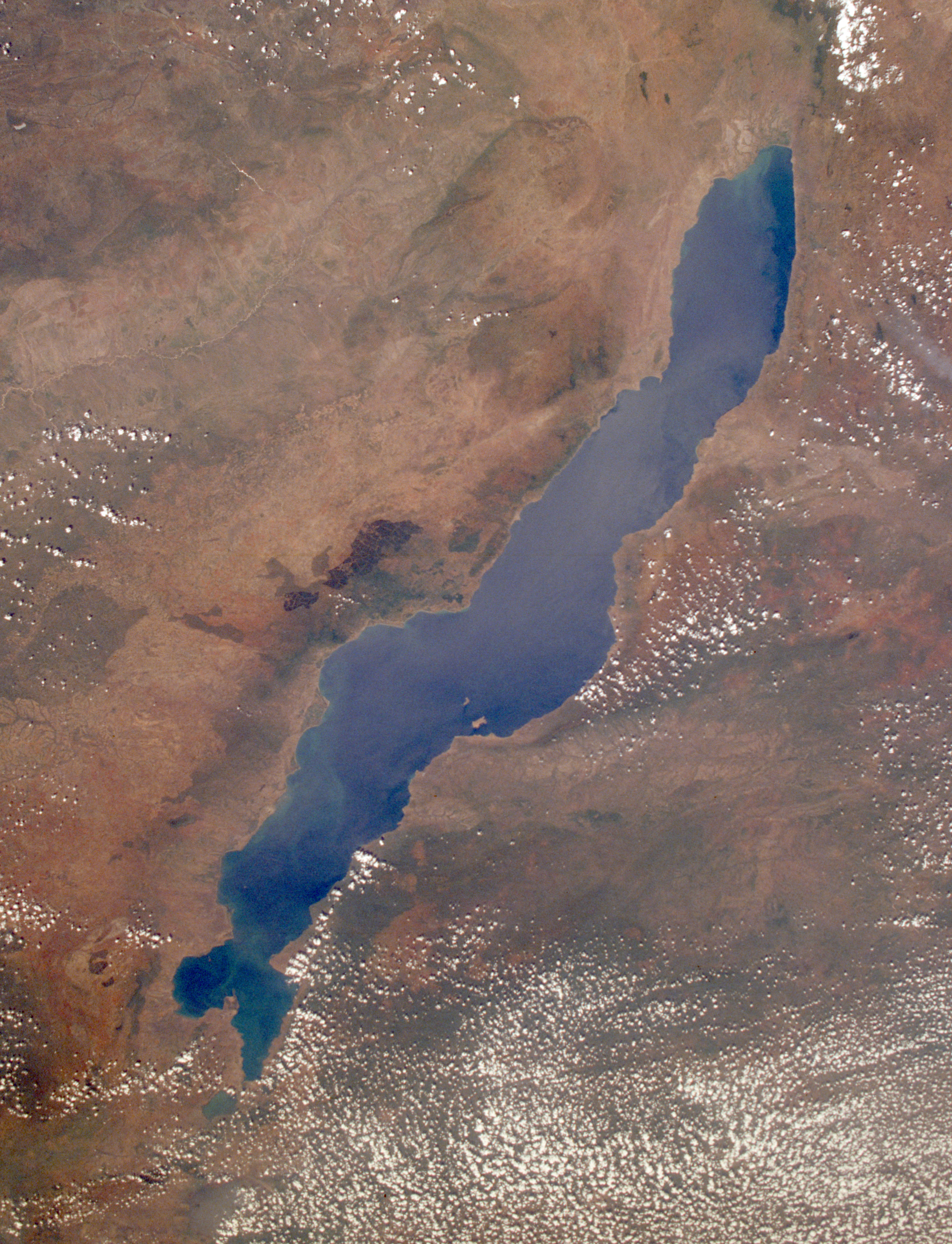
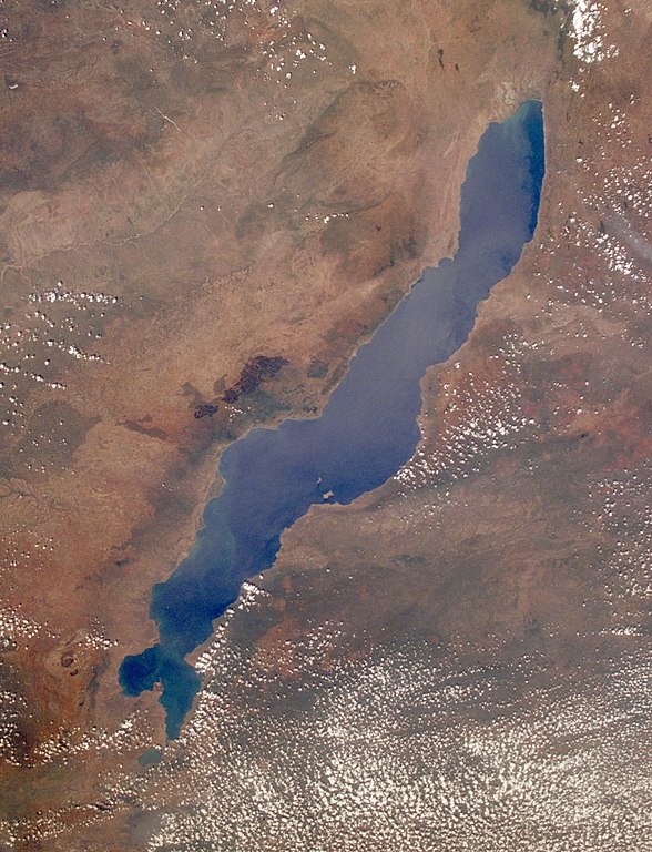
Datei:Lake Malawi seen from orbit.jpg
Größe dieser Vorschau: 459 × 599 Pixel. Weitere Auflösungen: 184 × 240 Pixel | 367 × 480 Pixel | 588 × 768 Pixel | 784 × 1.024 Pixel | 1.568 × 2.048 Pixel | 2.778 × 3.628 Pixel.
Originaldatei (2.778 × 3.628 Pixel, Dateigröße: 3,24 MB, MIME-Typ: image/jpeg)
Beschreibung
| Beschreibung |
English: Leverkusen in Germany, photographed by astronauts aboard the Space Shuttle. Original image courtesy of the Image Analysis Laboratory, NASA Johnson Space Center (eol.jsc.nasa.gov). Image ID: STS061-75-48. Image cropped, sharpened and gamma-corrected.
|
| Datum | Aufgenommen am 3. Dezember 1998, 09:49:31 UTC |
| Quelle | https://eol.jsc.nasa.gov/SearchPhotos/photo.pl?mission=STS061&roll=75&frame=48 |
| Urheber | National Aeronautics and Space Administration (NASA) |
| Andere Versionen |

Diese Mediendatei wurde vom Johnson Space Center der US-amerikanischen National Aeronautics and Space Administration (NASA) unter der Datei-ID STS061-75-48 kategorisiert. Diese Markierung zeigt nicht den Urheberrechtsstatus des zugehörigen Werks an. Es ist in jedem Falle zusätzlich eine normale Lizenzvorlage erforderlich. Siehe Commons:Lizenzen für weitere Informationen. Sprachen:
|
Lizenz
Diese Datei ist gemeinfrei (public domain), da sie vom Image Science & Analysis Laboratory der NASA erstellt worden ist. Die NASA-Urheberrechtsrichtlinie besagt, dass „NASA-Material nicht durch Urheberrecht geschützt ist, wenn es nicht anders angegeben ist“ (NASA-Urheberrechtsrichtlinien-Seite oder Nutzungsbedingungen für Fotos von Astronauten). Die Aufnahme ist Teil der Reihe The Gateway to Astronaut Photography of Earth. Bildquelle: STS061-75-48.
|
Ursprüngliches Datei-Logbuch
Uploaded to en wiki by User:Worldtraveller; moved here by User:Tintazul. Full original description follows.
Dateiversionen
Klicke auf einen Zeitpunkt, um diese Version zu laden.
| Version vom | Vorschaubild | Maße | Benutzer | Kommentar | |
|---|---|---|---|---|---|
| aktuell | 19:17, 30. Aug. 2019 | | 2.778 × 3.628 (3,24 MB) | wikimediacommons>Ras67 | high resolution, cropped and rotated from NASA's original TIFF |
Dateiverwendung
Die folgende Seite verwendet diese Datei: