Datei:NASA Mando-Koresand.png
Größe dieser Vorschau: 612 × 599 Pixel. Weitere Auflösungen: 245 × 240 Pixel | 620 × 607 Pixel.
Originaldatei (620 × 607 Pixel, Dateigröße: 962 KB, MIME-Typ: image/png)
Beschreibung
| Beschreibung |
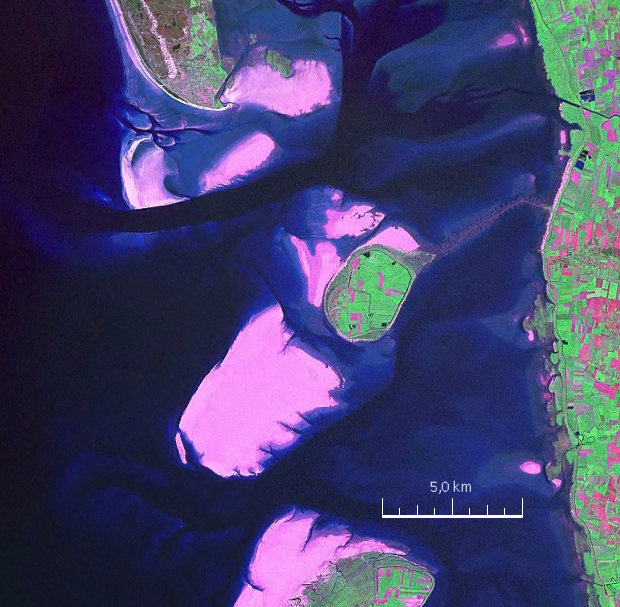
English: Mandø, the Danish Wadden Island, with Koresand close southwest, Fanø to the north, Romø to the south and the Jutland mainland coast to the east |
| Datum | |
| Quelle | NASA World Wind Screen Shot |
| Urheber | NASA |
Lizenz
| Diese Datei ist gemeinfrei (Public Domain), da es sich um einen Screenshot der NASA-Software World Wind handelt, in der ein gemeinfreier Datensatz wie Blue Marble, MODIS, Landsat, SRTM, USGS oder GLOBE verwendet wird.
|
 |
| Bildnotizen | Diese Datei ist annotiert: Betrachte diese auf Commons. |
Dateiversionen
Klicke auf einen Zeitpunkt, um diese Version zu laden.
| Version vom | Vorschaubild | Maße | Benutzer | Kommentar | |
|---|---|---|---|---|---|
| aktuell | 17:57, 19. Aug. 2009 | | 620 × 607 (962 KB) | wikimediacommons>Ratzer | {{Information |Description={{en|1=Mandø, the Danish Wadden Island, with Koresand close southwest, Fanø to the north, Romø to the south and the Jutland mainland coast to the east}} |Source=NASA World Wind Screen Shot |Author=NASA |Date=2000 |Permission= |
Dateiverwendung
Die folgende Seite verwendet diese Datei: